I am not sure who had the idea to run the main ridge of Japan’s Central Alps, but it could have been me. I am certain, however, who it was that suggested we forgo the convenient bus and the ropeway to the ridge. That was my friend, Tony.
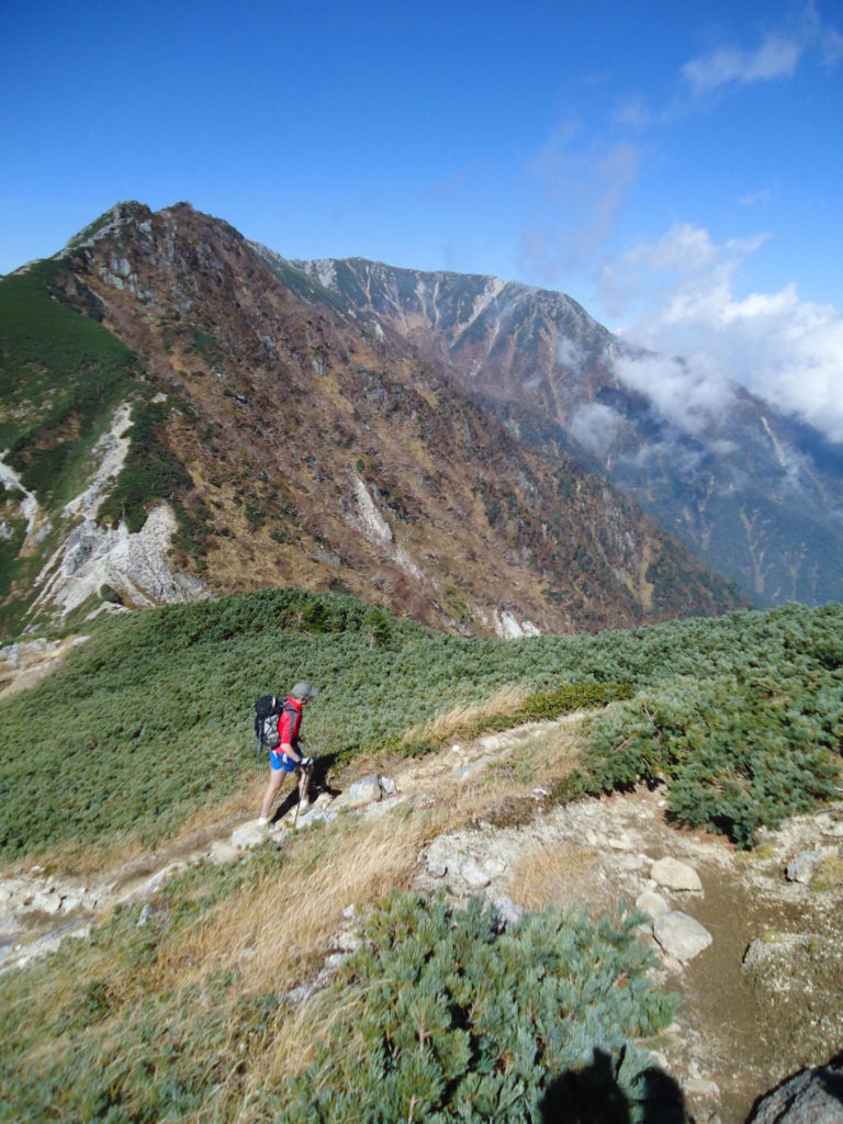
After the much-too-early alarm went off, Tony and I emerged from our tents to see the northernmost ridge of the Central Alps—Japan’s Hida Range—towering above us in the breaking light of morning. It was early October, and autumn was giving some burnish to the alpine grasses almost 3,000 meters up, but the sky was crisp and brilliant—perfect weather for trail running.
“About 45 minutes to the top, eh?” we joked.
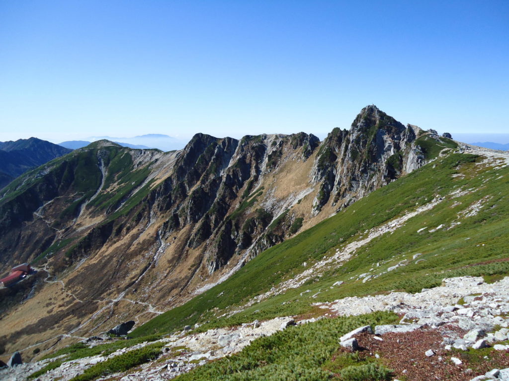
The plan was to camp near our projected finish point far below Utsugitake (Mt. Utsugi), then run from the trailhead up Kisokomagatake (Mt. Kisokoma) instead of taking the ropeway to the top. The run would then follow the long ridge in a north-south direction to Utsugitake where we would then descend back to our camp spot.
The run would take in two of Japan’s most impressive hyakumeizan (100 famous mountains) in one day. Although it may have been done before, it is part of our vague long-term goal to set certain trail standards and records for long distance runs in Japan. It is a project in quiet progress.
By coincidence, I had flown over the Central Alps ridge just two weeks before on a flight from Tokyo to Seoul. When I arrived back in Japan, I discussed the run with Tony.
“Looks pretty ‘runable’ on top. Maybe we can knock off the whole thing in nine hours or less,” I offered.
“Maybe as little as seven and a half,” suggested Tony, “if we bomb the downhills.”
After a light breakfast, we hid our tent and extra gear in the bushes, covering them up with loose branches for camouflage. As always, we were to run fast and light, carrying the minimum amount necessary for the run; some water, light food and basic warm clothes. After reaching the trailhead above the town of Komagane and snapping a few photos for posterity, we headed off.
The trail started out as a double-wide track, probably an old dirt road used years past in logging or dam construction. After 30 minutes of running, we passed a climber stopped by the side of the trail. Few climbers bother to approach the north end of the Central Alps from its base, since the ropeway whisks hikers up 2,631 meters (at a round trip cost of ¥2,200).
We continued up the trail, which became sketchier and sketchier, leading to the observation…wait, we were going the wrong way! The hiker we saw below was standing in front of the small sign that marked the correct course. So down we went, back to where we had been more than 30 minutes before. We would need to revise our run time a bit.
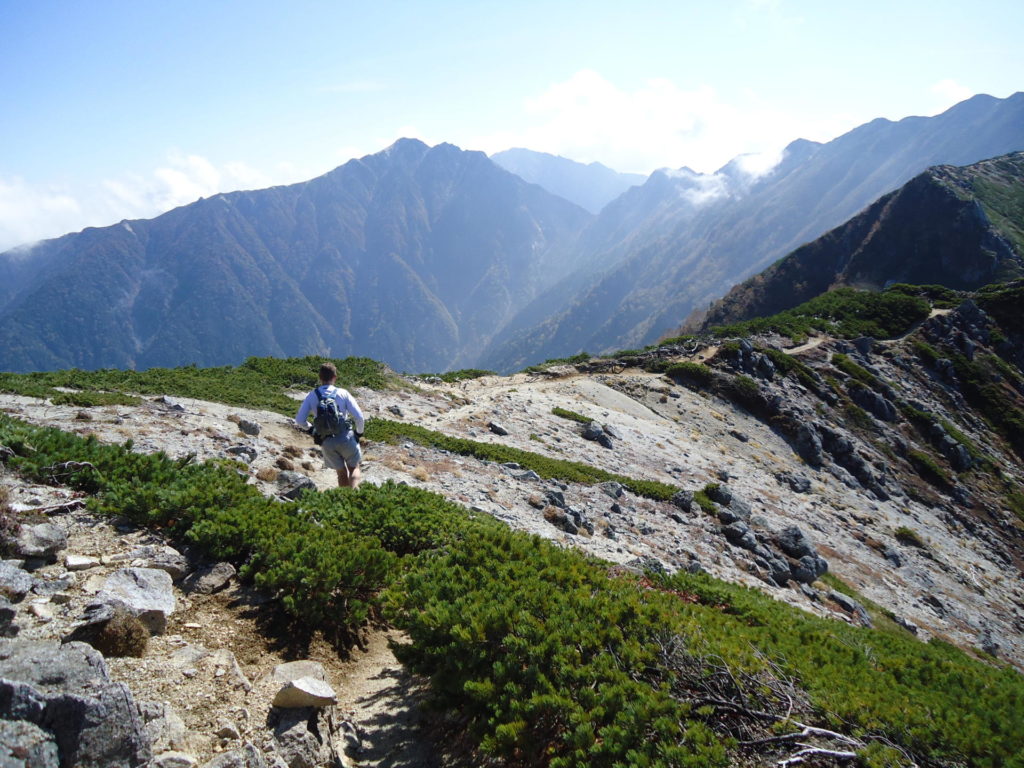
The correct trail went in the only direction it could-—sharply upward. We ran a surprising amount of the steep slope and arrived above tree line in very good time. There are advantages and disadvantages to running with our light-and-fast ethic and, as we arrived at Tengusou Hut, the first disadvantage of the day became apparent.
The hut was closed for construction. There was no water or drinks to be had, except for four or five deceptive drops that fell from a faucet after we banged the knob, somewhat more aggressively with each whack. Neither of us had any water left, and we’d been out for some time; there was nothing to do but continue over the first high peak, Nakadake, and hope for better luck at the next hut.
The trail from the ropeway joined our course from Tengusou Hut, and dehydration drove us around the slower moving hikers at speed. I dislike carrying more than about 500 ml. of water, or a full liter in a pinch, since beyond that weight running alpine uphills becomes more of a slog. I often choose to live with a certain amount of dehydration. Others may enjoy having a greater safety net despite the weight but, for me, more weight means hiking rather than running.
The other danger of light and fast alpine running is rain and the potential for hypothermia. But there was to be none of that on the ridge this day, which was fortunate because often the best strategy for a trail runner in poor weather is to put on whatever warm clothes you have and descend.
However, on the main ridge of the Central Alps, once you bypass the ropeway, descent trails can be hours apart. Escaping the weather is not at all easy on such a long and exposed ridge. Inexperienced runners should take great care to assess conditions before heading out on such long and exposed ridges with minimal gear.
After snapping off a couple of summit pictures on 2,956-meter Mt. Kisokoma, a water refill, and a bowl of instant noodles at Kisokoma Hut, we doubled back for the main event—the huge ridge between the two hyakumeizan mountains.
Tony had been greatly looking forward to the challenge of Hokendake (Mt. Hoken), a huge palisade of rock that requires a great deal of scrambling through chimneys and chutes. Here Tony announced he was determined to forgo the use of any of the chains provided for climbers, and he would free climb everything.
I had hiked this section years before, carrying a huge backpack with a sleeping bag and tent. The freedom of having almost nothing with me and easily making my way over the rock was a delightful contrast to the plodding experience with a pack.
The Japanese climbers who braved Hokendake, with packs and full alpine gear, were rather astonished to see two guys in shorts, running shirts and trail running shoes. Tony, true to his ethic, free-climbed the entire complex, not once touching chain.
From Hokendake, for the next three hours, we made our way toward Utsugitake on a trail that was absolutely nothing like it had appeared from the plane. Far from “bombing” the downhils—gullies and fields of scree slowed our pace to a shuffle or a sideways jog, when even that was attainable.
Generally, a long distance trail runner can finish an alpine course in less than half of the map time for a hiker (perhaps a third of map time on downhills), but we were far over those averages on this complex ridge. It was becoming apparent this traverse was going to take us much longer than expected, even though we were running well and not terribly tired, considering we had been moving for six hours.
The least happy topic during the run was the one I broached with Tony the first hour. I had been diagnosed with second stage melanoma a few days before our run. A Tokyo hospital had given me a sealed envelope to present to the Japan Cancer Center in Tsukiji, Tokyo, once I got back. The melanoma was a souvenir of my childhood spent on California beaches.
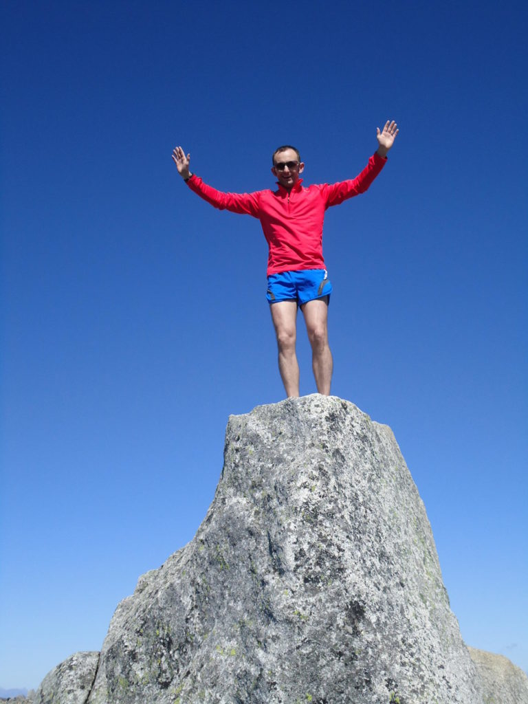
Tony was considerate enough to not dwell too much on the unhappy diagnosis, since I really didn’t feel like talking about what was going to happen next, for it was all unknown. Putting it out of mind completely was impossible though, since I could somehow feel the little melanoma on my back, especially when sweat hit it. It was like the little bastard was running behind me, a most unwelcome competitor I wanted to leave behind on the trail but could not.
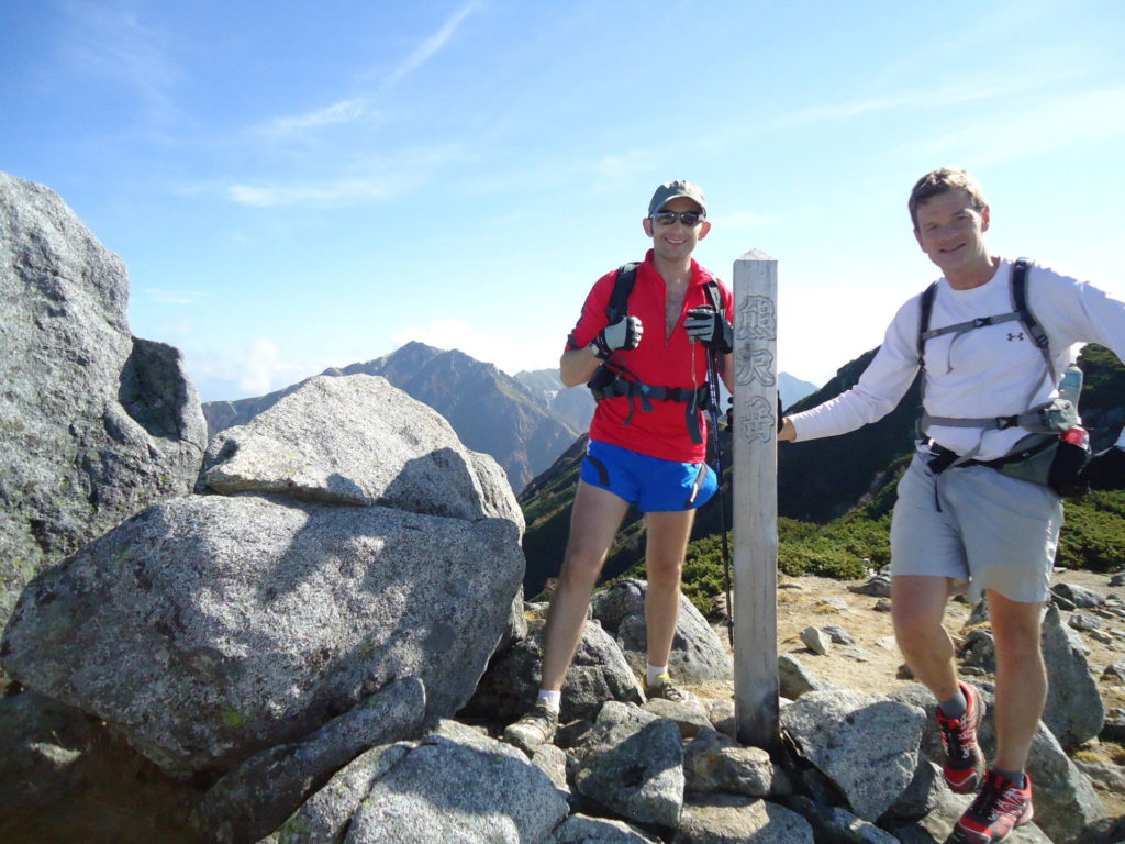
The ridge became more and more remote as we went. We encountered few hikers, but at the top of Kumazawadake we saw the most amazing sight; two figures running up the mountain toward us. One arrived doubled over and out of breath, the other arrived retching and cursing several minutes later. When he recovered, the first looked up and said, ”Robaato?”
It was then I recognized one of my neighbors from my town of Hanno, Saitama, Kobayashi-san (Mr. Kobayashi). What were the odds of that? He and his group were running the exact same course in the other direction. Their plan was to use the ropeway back down and, now that we were approaching seven hours of running, I could hardly blame them.
Finally, just before a long descent, the utterly massive bulk of Utsugitake appeared in front of us. I am not sure I have seen such a huge buttress anywhere in Japan, except perhaps Kitadake in the Southern Alps. The trail up looked to be a heartbreaker.
No pictures in guidebooks or views from planes could have prepared us for the psychological jolt of the scale of this climb so long into our run. For the next hour, the word “run” really could not apply to our ascent up the slope. We fast-climbed, as well as we could, moving in automatic gear while our bodies and minds struggled with the punishment Utsugitake delivered.
At the top, the sun began setting as clouds moved in below us. The drama of the scenery re-energized us even though we had been on the move for almost 10 hours. As darkness set in, we took out our lights and donned jackets.
“Let’s get this damned thing done,” I said.
Tony nodded agreement, and we took off downhill as fast as our legs could function, until we entered a muddy knife-edge slope where both sides fell into what seemed to be a dark and infinite void. There we spotted a sign which said in large red Japanese letters, with English below for emphasis, “Place where fatalities frequently occur, next 400 meters.”
“Looks like we walk,” I suggested.
The idea of walking was not completely unwelcome. When it was safe, we picked up the pace again, continuing to run for several more hours, through forests, through a dream-like haze and finally to a road not far from where we had left our gear.
Our Central Alps ridge run had taken 13 hours, and we been on the move for all but about 30 minutes, stopping briefly at mountain huts and to get water. We ate a hearty dinner and talked about what to do next. A full circuit of the South Alps?
In my case it was back to Tokyo, where Japan Cancer Center did its job (thanks, guys), and I learned I would have plenty more opportunities to run in Japan’s mountains. I have not increased the amount of water, food or clothes I take, but I do now allow for the weight of a tube of sunscreen.
About the Author: Robert Self is originally from Northern California’s redwood country and has been guiding people into Japan’s mountains for 20 years. He is known in Japan as an apostle for the sport of trail running and has coached people of varying skills, from beginners to international champions. He is the director of Hanno Trail School (www.hannotrailschool.com), specializing in running tours of Japan’s mountains and trail running lessons.
Trail Running near Tokyo: Guides and Clubs
- Seven Hills Adventure: Seven Hills usually has several trail runs near Tokyo each month at reasonable cost. Instructors speak Japanese only. Web: www.sevenhills.jp
- Hanno Trail School: Easy forest runs to multi-day alpine adventures near Tokyo. Usually mixed foreign and Japanese groups, with English and Japanese spoken. Web: www.hannotrailschool.com or www.tokyotrailrunning.com
- Namban Rengo (Running Club): The club mainly does street runs in and near Tokyo, but they have periodic trail runs for those who join as well (English spoken). Web: www.namban.org
- The Genki Gaijin: A loose circle of hardcore trail runners in Japan who get together several times a month for runs. Japanese and foreign members welcome. Runs tend to be “challenging.” Contact Robert Self for more information at r.self@bluetreeco.com
Trail Tips: Alpine Running in Japan
- Water: Waterborne diseases such as giardia are almost unknown in Japan, and almost all hikers and trail runners avail themselves of water from mountain springs and streams. Streams in Japan are very short and sharp, and high mountain pastures for cows are extremely rare. A runner can greatly extend his possibilities by utilizing water from clear streams, springs and mountain huts.
- Mountain Huts: Japan has an excellent hut system, and an overnight stay is a superb way to make the logistics for a multi-day run much easier. Most manned huts also provide meals, either included in the price of a stay or as a separate cost. Nevertheless, the time of the year when huts are open vary greatly. It is a good idea to check in advance. Some also become fully booked during busy weekends and holidays. Overnight stays generally cost ¥7,000 to ¥8,000.
- Trail Running Gear: The number of running stores carrying trail running equipment has increased dramatically in recent years. Perhaps the best chain for gearing up is Art Sports which has branches in Shibuya, Okachimachi and Hibiya (Web: hwww.art-sports.jp). Foreign runners who cannot find their preferred brand or size in Japan might try Zombie Runner (Web: www.zombierunner.com) in the USA, which provides excellent service for foreign shipments.
- Maps: Japan may have the most comprehensive and detailed hiking maps of any nation. Most medium-sized bookstores will sell Shobunsha’s superb map series 山と高原地図 (Mountain and Trail Maps). These are in Japanese, so those not familiar with the language should carefully study place names in advance to prevent mishaps.
- Weather and Seasons: Above 2,500 meters, the most reliable seasons for running are late July to the end of August. Remnant snow can be a problem in late July (particularly in the North Alps), while thunderstorms can be a problem throughout the period, with frequency and power often increasing as the season goes along. The end of September to the middle of October is another excellent season for alpine running, with slightly more stable conditions settling in over the Japanese archipelago. Cold can be a problem in October, so runners should come fully prepared for potentially bone-chilling conditions.


