Some say the name Ibuki (strong exhalation) comes from the powerful winds common on Mt. Ibuki. As the wind picked up and the approaching storm made its way ever closer, I was convinced. “Ame ona (rain woman) does it again,” I thought to myself.

The day before I had been hiking in Nara and had spent the morning and afternoon hitchhiking north to Shiga Prefecture. I arrived at the trailhead at half past 3 p.m. knowing I was getting a late start. The place looked pretty empty except for a woman at a small kiosk and another oba-san outside a pension sweeping the porch.
As I walked past the kiosk, the woman called out “Itterashai!” (Have a good one.) I smiled and asked if she minded me leaving my gigantic pack near her shop to save time. She was more than happy to let me leave it and warned me that nightfall would be here before I knew it.
I speedily made my way along the trail, stopping to take few photos and enjoying the spring flowers and plants along the way. This mountain was vibrant with life. I looked down, and a few snails were right in squashing distance on the trail so I moved them carefully into the grass.
I had read in a guidebook that 300 million years ago, Ibuki-san was a volcano under the sea and, after it raised into a landmass, was perfect for creatures to grow due to the heavy mineral deposits. The calcium especially made it easy for shelled creatures such as snails to live.
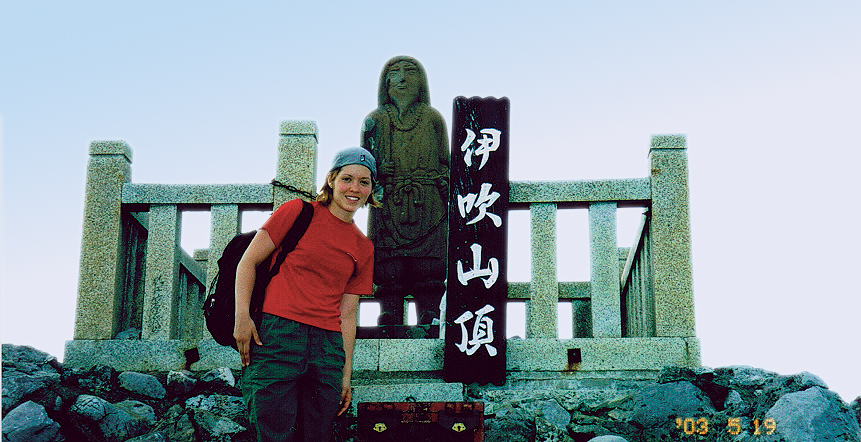
Reaching the top, I was disappointed the hike was so short, but grateful since the sun was setting. I was at the summit but looked around, and the mountain felt wide, as if it extended forever. I finally understood what adventurer and creator of the original hyakumeizan list, Kyuya Fukuda meant when he said this mountain “had volume.”
Trail Tips
From the seventh station, the trail gets pretty steep, and the rocks underneath you on the trail are a bit loose, so watch your step. As winter approaches, the area will become a ski resort and bus service times will change, so confirm availability before you depart.
Mountain Stats
Mountain: Mt. Ibuki
Difficulty Level: 2 out of 5
Location: Border of Shiga and Gifu Prefectures.
Peak: 1,377 meters
Duration: One-day hike
When to go: April-November
How to get there: Take the Shinkansen from Tokyo to Nagoya and transfer to a local train on to Maibara Station. From there, take a bus to Aomi-Nagaoka, which will bring you to the trailhead.
Getting There
Tokyo Station ⇒ Nagoya ⇒ Maibara ⇒ Aomi-Nagaoka ⇒ Ibuki-san Trailhead
(1 hr, 40 mins. 6,090) ⇒ (9 mins. 230) ⇒ (41 mins. 1,280yen) ⇒ (12 mins. 290)
Contact Information
Aomi-nagaoka Taxi Service: (0749) 55-0106
Koukoku Bus Center: (0749) 64-1224
Ibuki-machi Tourist Information: (0749) 58-1121
Ibuki Family Log House: (0749) 58-1323
Things Not to Miss
If you want to stay a few days and enjoy skiing in the winter or canoeing on Lake Hakuryu, check out the Ibuki Family Log House Nature Villa. A one-night stay with two homemade meals will run you about 9,000. Ski season starts from Dec. 22.
www.biwa.ne.jp/~p-ibuki/
Recommended Hiking Schedule
3 hours, 20 mins.