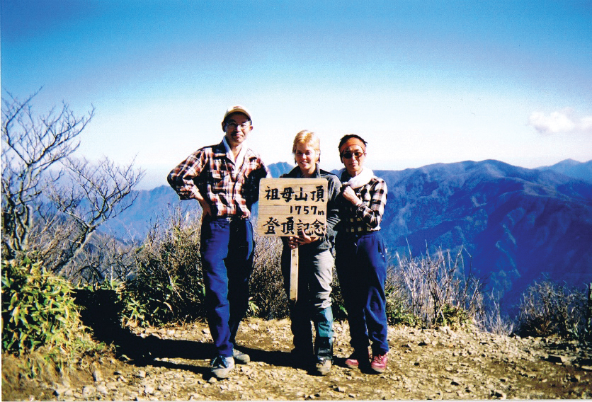
It was my fifth day and mountain number two in Kyushu. Hitching a ride from an onsen in Beppu was easy and, soon enough, I was on the trail as it was beginning to get dark. Damp air and rusty fingers made it difficult to get a fire going in the hut on Mt. Sobo. Luckily pieces of an old dried-out door caught quickly and the room was soon smoky and warm.
I sleep soundly until 3:30 a.m. and then I am just cold. There is a sticky, damp cold—like a layer of ice pudding against your skin. The kind of cold that makes you check to see if your toes are still attached. It’s too cold to move or sleep, so I just lay there for a few hours.
I attempt to boil tea in my titanium cup and resort to filtering out the ashes with a handkerchief. My food rations consist of coconut cookies, one salmon onigiri and beer snacks. In my hurry to reach the cabin before nightfall, I skipped the stop at a convenience store and figured I would make do with what I had in my pack. The idea of burning to death or suffocating disturbs me, and I drench the fire pit with water, preferring the cold to bad dreams of hell.
Trail Trivia #1: In 1945, a B-29 bomber crashed into the mountain and is still there, along with an American flag.
I eat beer snacks for breakfast (minus the beer) and feel sad about my meager food situation, but the sun comes out, so I stop feeling sorry for myself in the damp, dark hut and get ready to greet the day. Despite still being winter, the sun is warm on my skin, but my heavy pack sucks. I can feel the lack of calories as I can hardly walk with the weight of the pack, and it takes me an eternity to get to the summit.

On the descent, I am exhausted and think of sleep, food, and a bath, in that order. I travel through a tunnel of arched bamboo, and the leaves just touch the top of my pack. Feeling fine to be small, I suddenly get a burst of energy and fly through as if I am racing someone on the outside of the tunnel, but the trail gets rough, rocky and then…where the hell am I? The trail has disintegrated into a mere line, and I am in the middle of the forest.
I retrace my steps and find myself in the same place twice. Great… I can see where the trail used to lead and figure I’ll just descend using the old trail, which would be totally feasible if I had a machete, but it is dense and I am out of luck.
Finding the trail again I am finally down at the trail head parking lot where I run into three hikers I had met on the summit. They offer me a ride down into town and, after an onsen, we heartily eat yaki-niku and drink too much beer. That night I stay at the home of one of the hikers’ friends and sleep like the dead.
Trail Trivia #2: Mt. Sobo is named for Emperor Shimu’s grandmother.
MOUNTAIN STATS
Mountain: Mt. Sobo
Difficulty Level: 2 out of 5
Location: On the border of Kumamoto, Miyazaki and Oita prefectures.
Peak: 1,756 meters
Duration: Day hike
When to go: May to November
Things to bring: Raingear, flashlight, map, camera, sunscreen, water, camera, gloves, sunglasses, warm hat, food supplies.
Getting Here
From Tokyo, fly to Oita Airport in Kyushu. From there take a train or bus to Ogata and transfer to a separate bus to Uehata. A short bus ride will take you to Obira, where the trailhead starts. Note that bus service is not so frequent, so renting a car is recommended.
Getting There: Haneda – Oita – Ogata – Uehata – Obira trailhead
(Takes 1 hrs. 45 mins. / ¥28,000) – (48 mins. / ¥7,900) – (45 mins. / ¥710) (25 mins. / ¥320)
Contact Information
Takeda town taxi service: (0974)-63-3151
Ogata Tourism Bureau (Sangyo-shinko-kai): (0974)-42-2111
Things Not to Miss
If you are heading back toward Takeda City, stop by Takeda Onsen “Takeda Cha-ryo” (0974) 63-3261.
If you are near the town of Takachiho, take a ride on the “Toroko,” a two-car train that has a great view over the valley. www.torokko.jp
Those who want to stay over night as they make their way back north can relax at Gozenyu, a beautiful ryokan with a unique atmosphere and relaxing onsen.
www.gozenyu.com
Recommended Hiking Schedule
Day One: 6 hrs., 30 mins.


